A well-known aphorism states that “your health cares more about the zip code than the genetic code,” thereby underlining the importance of social factors along with biological factors in the field of medicine. The place where we live, as a reflection of the socio-economic situation in which we get along in life, affects health as much or more than genes. Perhaps it would be more correct to say “genetic sequence versus census tract”; the recent pandemic has corroborated this relationship.
The COVID-19 Atlas in Havana.
The Faculty of Geography of the University of Havana presented at the end of March of this year an exciting atlas — Havana: COVID-19 Atlas —, of unquestionable interest not only for health but also in sociology. In seven chapters and 200 pages, about twenty authors and fifteen institutions unfold a descriptive and analytical tour of the first two waves of the pandemic in the city in 2020. The geographic focus constitutes the backbone of the description and of the analyses.
One of the first things that stands out is the abundance and diversity of the information collected for each of the city’s health areas. Havana is covered by 82 health areas with quite dissimilar characteristics, according to the diversity of the capital’s territory. The areas cover an average of about 27,000 inhabitants, but their size varies depending on the housing density that can range, at the municipal level, from 12 inhabitants per hectare in Habana del Este to 392 in Centro Habana.
In addition to collecting indicators of risk diseases and demographic data, it ventured into some new fields. For example, under the assumption that it will be more difficult to stay at home in areas of high overcrowding and high temperatures, the latter identified based on the digital processing of images from the thermal infrared sensor (TIRS) of the Landsat 8 satellite. Another innovative example is the analysis of inter-municipal urban mobility patterns based on cell phone traces in the telephone tower network. In fact, the monitoring of mobile phones can provide invaluable information in various fields of study, such as that of daily inter-municipal mobility.
As a result of the analysis of the available information, vulnerability to COVID-19 could be mapped at the health area scale, taking into account:
- Biological: over 60 years and prevalence of chronic diseases (hypertension, diabetes, asthma….)
- Sociodemographic: density, overcrowding, number of precarious neighborhoods, number of services (such as centers that promote transmission).
In the mapping of the results, central municipalities such as Old Havana, Regla and Centro Habana stand out negatively, as well as some peripheral areas in Mariano, 10 de Octubre, Boyeros, La Lisa and San Miguel del Padrón.
The last chapter of Havana: COVID-19 Atlas is specifically dedicated to vulnerability, the impact of COVID-19 and the resilience to the pandemic. To do this, four dimensions were analyzed and mapped in each health area:
- Vulnerability to chronic diseases (hypertension, diabetes, asthma….)
- The incidence of the virus
- Recovery of areas
- The economic and infrastructure vulnerability by census tracts.
This last factor is extracted from the 2012 census information in each of the almost 3,000 districts of the city, of which 299 with high and 355 with very high vulnerability. Together, these two groups represent 22% of the city as a whole. Five indicators are selected from the census information:
- Economic dependence (weight of the non-economically active population over the active one)
- The rate of economic activity
- The presence of precarious neighborhoods (with 50 homes or more) or precarious centers (less than 50), understood as physical precariousness, that is, with insufficient or poor housing and infrastructure.
- The percentage of tenement houses and improvised dwellings over the total dwelling.
- The percentage of homes with water outside the premises.
An economic and social vulnerability map of the province is drawn up with all this at the census tract scale, where a significant dispersion of these vulnerable areas, present in almost all municipalities, is confirmed. Unfortunately, the expected crossing of this level of vulnerability against that of incidence, in order to be able to verify the hypothesis that the incidence should have been higher in these vulnerable areas, does not exist.
There are only some general conclusions at the level of central, intermediate and peripheral areas or at the municipal level, but the issue is not addressed by vulnerable and non-vulnerable areas, which in fact could constitute the main interest of the study. Failure to do so with this approach may even hide some causal relationships, such as when a higher incidence of COVID-19 is found in black or mixed-race people when in reality it is a relationship between race and poverty; as well as between poverty and greater vulnerability to contagion.
Seen since October 2021, after having experienced the third and most serious wave of the summer of this year, in a way the atlas becomes an unfinished work. On the one hand, at the end of the statistics collected in November 2020, the study does not take into account the most serious period of the pandemic (which, in addition, presented morbidity and lethality characteristics different from the first waves: greater infections in pediatric ages, a predominance of symptomatic people, etc.). On the other hand, the verification of the hypothesis that related vulnerability with incidence was unfinished. Completion of the investigation with the most recent data would be very welcome.
City and health
Reading the work will also follow some more general reflections. In the first place, it is appropriate to recall and underline the essential importance of properly adjusting the “focus” — the scale — in the socio-geographic analyses. For example, at a time when Cuba is giving increasingly more importance to “municipalization” in the investigative approaches and in the formulation of social and economic policies, the limitation of boundaries can make phenomena such as intermunicipal mobility invisible, or that of the chains of infections where real cases are shown in which a single patient can generate chains of infections throughout the metropolitan territory. Processes that work at that level “disappear” on smaller scales. At the other extreme, great care must be taken in choosing the geographic framework for statistical analyzes. Excessively large units of analysis can also disguise and hide undeniable realities. It is not the same to analyze vulnerability at the scale of large urban areas (central, intermediate, peripheral) or municipalities, as in smaller areas. At these larger scales, the statistical averages conceal the enormous differences that are found between smaller units such as health areas or census tracts. It is the well-known danger of “averages,” which tend to hide notable differences…
In terms of causal relationships, given that COVID-19 is transmitted by close contact, from its inception the main explanatory hypothesis for its greater or lesser incidence was generally population density. Little by little, as the pandemic was studied, this information was relativized and something that had already been repeatedly verified in other analyzes came to the fore: there was a much more explanatory factor constituted by the socioeconomic characteristics of the population and the environment in which they lived. Given the tendency towards territorial grouping of the population by similar socioeconomic levels (by social groups and classes, by national or migratory origin, etc.), a differentiated urban geography is generated that characterizes the territory socially and culturally. With this, the space becomes a powerful social marker.
One of the most interesting phenomena of Havana’s social geography has been precisely the resounding change that occurred in the capital in the second half of the 20th century towards the homogenization of the different areas of the city in the capitalist stage. Now it was possible to find unhealthy tenement houses and health risk areas in privileged areas such as Vedado or Miramar, while highly qualified professionals could live in areas with difficult urban conditions. With this, the place of residence was losing social status significance. This process, however, has been reversing in the last decade with the emergence of private businesses and the rebirth of a real estate market based on the authorization for the buying and selling of housing. Phenomena of relocation due to socio-professional status and even gentrification processes have been gaining strength and resignifying many areas of the city.
The urban geography of health is related to this. Today, in a “first world” city such as Barcelona, there are particularly striking social and health imbalances between the city’s districts. The differences in life expectancy between areas of the same city reach 10 years, while although there are districts where teenage pregnancy no longer exists, in others it represents up to 36% of the total.
The same differences found in morbidity between first and third-world countries in treatable diseases such as tuberculosis due to imbalances between prevention mechanisms, early diagnosis and effective treatment possibilities, are also found within the cities. In Barcelona, for example, out of every 10 cases of tuberculosis, four occur in the poorest neighborhoods. And Barcelona is no exception, this can be seen in most cities.
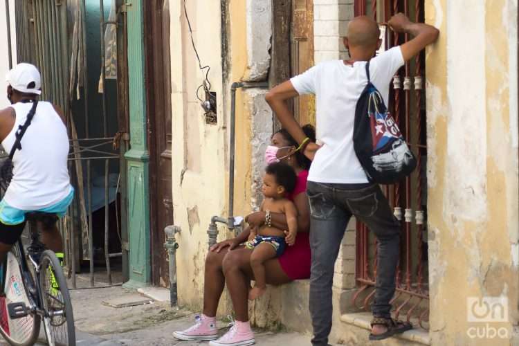
Even in those societies that enjoy a universal and free healthcare system like ours, living conditions mark the chances of contagion. Living in small and uncomfortable spaces promotes the spread by proximity, both within the home and in the neighborhood (families cannot be kept indoors with a minimum of conditions). They are areas where food intake is often worse, where the remoteness or inexistence of jobs and commercial facilities requires long journeys, increasing the probability of contagion, where the characteristics of the technical infrastructures are much more deficient… Not all of us are equal in relation to the virus, not only biologically but also socially.
An important conclusion can be drawn from this: as expert epidemiologist Michael Marmot says: “If the main determinants of health are social, so should be the remedies.” Hence the extreme importance of attacking not only biological deficiencies and vulnerabilities but also social, economic and cultural ones. Once again it is shown that health is not only the responsibility of the health system.


